
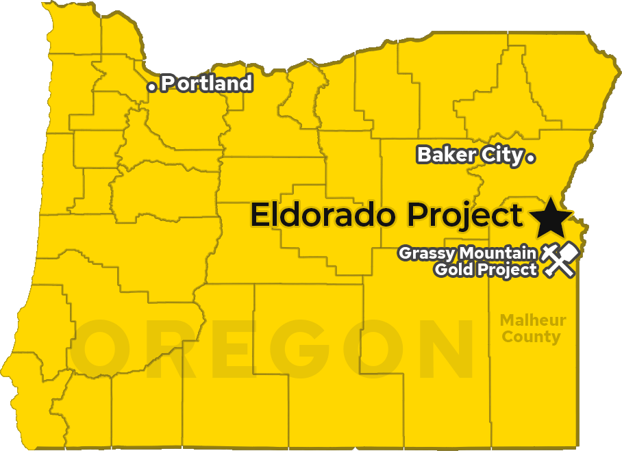
The Eldorado Project is a district-scale land position totaling 7,915 acres (32.03 km2) located 60 kilometres (38 miles) northwest of Vale in Malheur County, Oregon. The project benefits from excellent nearby infrastructure, road accessibility, and local and federal support, as evidenced by the nearby Grassy Mountain project, located just 36 kms SSW of Vale. The Grassy Mountain project recently signed a Record of Decision (ROD), by the Bureau of Land Management (BLM), which is the federal approval that completes the NEPA environmental review. This allows the project to advance from permitting into a construction ready stage on federal lands and paves the way for additional development of mining projects on federal lands in eastern Oregon.
The project consists of the Eldorado West and Eldorado East properties, both featuring highly prospective geology.
A NI 43-101 technical report has been filed for the Eldorado gold property. This historical database is currently not sufficient as the basis for developing a current mineral resource, but work is underway to verify and bring current the historical data.
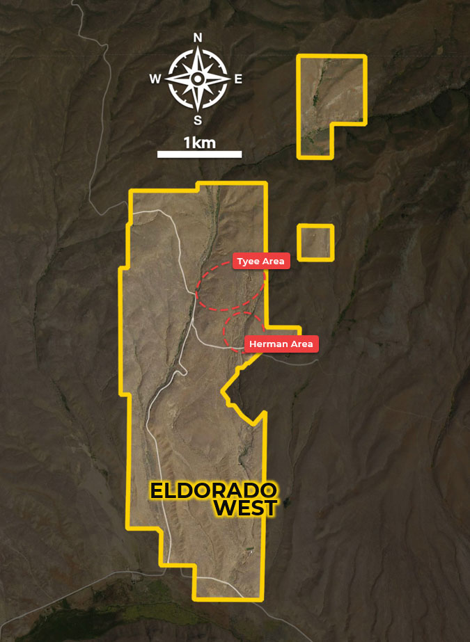
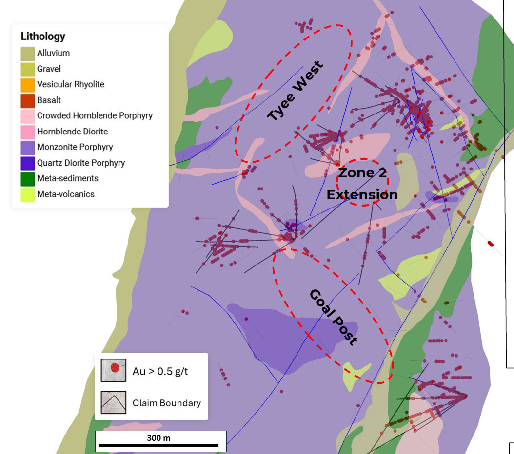
VIEW TECHNICAL REPORTThe 2,048-acre property hosts a large diorite intrusion-related gold system, with pervasive mineralization localized within and around diorite contacts and fault-related fracture zones — the likely pathways for bulk tonnage, high-grade gold deposition. Historic mining, drilling, gold-in-soil anomalies, and geophysical modelling indicate mineralized structures extend across the majority of the property, well beyond the currently confirmed system.
ED-03: 140.21 m @ 1.15 g/t gold
incl. 22.86 m @ 3.86 g/t gold
ED-04: 137.16 m @ 1.64 g/t gold
incl. 32.00 m @ 3.982 g/t gold
ED-07: 114.30 m @ 3.09 g/t gold
incl. 33.53 m @ 7.60 g/t gold
ED-11: 118.87 m @ 3.28 g/t gold
incl. 12.19 m @ 18.01 g/t gold
EC-01: 288.34 m @ 2.01 g/t gold
incl. 175.26 m @ 3.07 g/t gold
EC-02: 156.36 m @ 0.51 g/t gold
incl. 32.00 m @ 0.94 g/t gold
EC-03: 154.23 m @ 0.80 g/t gold
incl. 100.58 m @ 1.08 g/t gold
RC Drilling
ED-22: 30.48 m @ 0.47 g/t gold
and 1.52 m @ 160.60 g/t gold
ED-26: 92.96 m @ 1.55 g/t gold
incl. 25.91 m @ 2.39 g/t gold
ED-29: 254.51 m @ 1.56 g/t gold
incl. 19.81 m @ 5.94 g/t gold
incl. 4.57 m @ 20.33 g/t gold
Core Drilling
EC-04: 83.82 m @ 2.18 g/t gold
incl. 1.68 m @ 18.19 g/t gold
incl. 0.91 m @ 39.61 g/t gold
EC-05: 46.48 m @ 0.70 g/t gold
incl. 7.77 m @ 1.97 g/t gold
incl. 10.52 m @ 1.82 g/t gold
*All historical resource estimates are based on prior data and reports prepared by previous property owners. A qualified person has not done sufficient work to classify historical estimates as current resources in accordance with CIM (Canadian Institute of Mining, Metallurgy and Petroleum) categories and the company is not treating the historical estimates as current resources.
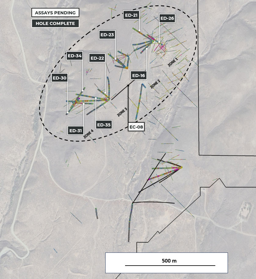
Intersected gold mineralization has confirmed broad, coherent, pervasive zones extending the open-ended mineralization from east to west over 800 meters, with new mineralization identified between Zones 2, 3 and 4.
ED-16: 117.35 m @ 0.27 g/t gold incl. 16.76 m @ 1.85 g/t gold
ED-21: 89.92 m @ 0.45 g/t gold incl. 51.82 m @ 0.62 g/t gold
ED-22: 30.48 m @ 0.47 g/t gold and 1.52 m @ 160.60 g/t gold
ED-23: 28.96 m @ 1.08 g/t gold incl. 7.62 m @ 2.46 g/t gold
ED-26: 92.96 m @ 1.55 g/t gold incl. 25.91 m @ 2.39 g/t gold and 1.52 m @ 11.61 g/t gold, extending mineralization northward
ED-30: 68.58 m @ 0.67 g/t gold incl. 9.14 m @ 1.18 g/t gold
ED-31: 117.35 m @ 0.59 g/t gold incl. 19.81 m @ 1.50 g/t gold
ED-33: 59.44 m @ 0.55 g/t gold incl. 6.10 m @ 1.03 g/t gold
ED-34: 15.24 m @ 0.71 g/t gold incl. 6.10 m @ 1.22 g/t gold
ED-35: 64.01 m @ 0.40 g/t gold incl. 15.24 m @ 0.84 g/t gold
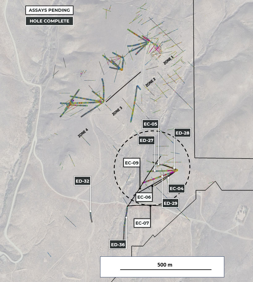
Drill holes ED-27, ED-28 and ED-29 intersected broad gold mineralization from surface and identified a new mineralized contact zone between the diorite intrusive complex and the host metasedimentary rocks. Drill holes EC-04 and EC-05 confirmed strong gold mineralization continues both north and south within the Herman Area, intersecting broad pervasive grades punctuated by high-grade intervals in mineralized contact zones, structures, and breccias.
ED-27: 179.83 m @ 0.67 g/t gold incl. 44.20 m @ 1.25 g/t gold
ED-28: 172.21 m @ 0.82 g/t gold incl. 108.20 m @ 1.01 g/t gold
ED-29: 254.51 m @ 1.56 g/t gold incl. 19.81 m @ 5.94 g/t gold and 4.57 m @ 20.33 g/t gold
EC-04: 83.82 m @ 2.18 g/t gold incl. 1.68 m @ 18.19 g/t gold incl. 0.91 m @ 39.61 g/t gold
The Eldorado East addition increased the size of the land package by approx. 5,867 acres (23.74 km²) through a combination of staking and an option agreement. The property hosts numerous mines and prospects, including two historical open-ended resource estimates*:
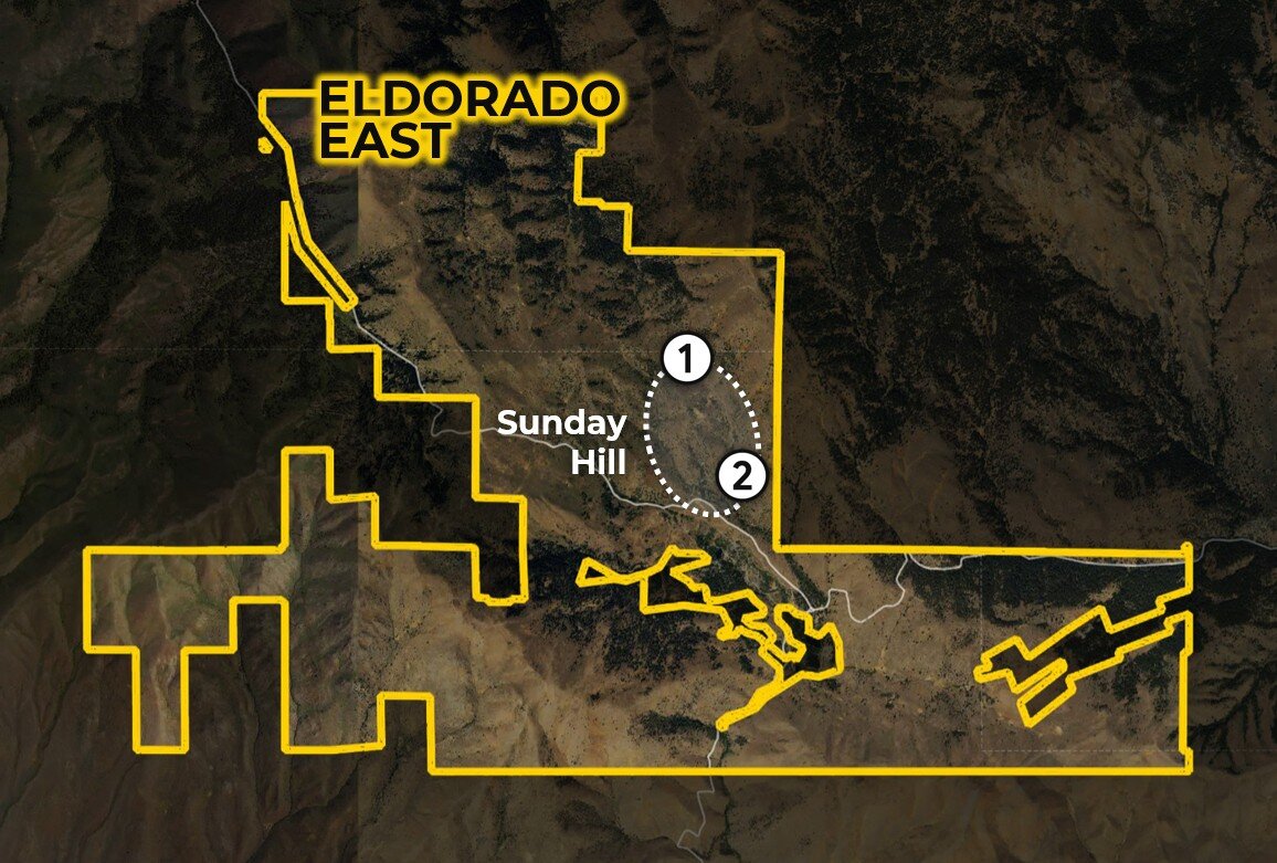
154,000oz+ @ 23.15 g/t gold*
50,000oz+ @ 9 g/t gold*
*The referenced resource estimates for mine sites on the Sunday Hill Property are considered historical in nature, are based on prior work prepared by a previous property owner, and do not conform to current CIM categories. While the Company considers the estimates to be reliable, a qualified person has not done sufficient work to classify the historical estimates as current resources in accordance with current CIM categories and the Company is not treating the historical estimates as a current resource. Significant data compilation, re-drilling, re-sampling and data verification may be required by a qualified person before the historical estimates can be classified as current resources. There can be no assurance that any of the historical mineral resources, in whole or in part, will ever become economically viable. In addition, mineral resources are not mineral reserves and do not have demonstrated economic viability. The Company is not aware of any more recent estimate prepared for the Sunday Hill Property.
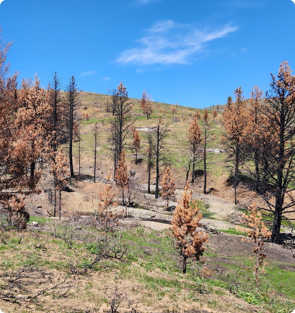
Looking south of Sunday Hill. Trees that grew on old mine tailings from both lode mines and placer mines were burned by wildfire in 2024. Traces of historic mining extend far beyond Sunday Hill, demonstrating that the gold system extends over a much broader area.
The Mormon Basin extends across much of the Eldorado East property
Hosts numerous historic high-grade lode and placer gold mines dating back to the late 1800s and early 1900s
Has seen very little systematic or modern exploration
Provenance believes the near-surface historical gold mineralization in and around the Mormon Basin is part of a potentially large bulk gold system that includes both the original Eldorado and the new Eldorado East expansion
2025-2026 Program
Provenance completed ground truthing and data compilation in 2025 and is planning a maiden drill program for summer 2026.